
Integrating City Open Data for Environmental Impact
The Massive Data Institute (MDI) is developing the Environmental Impact Data Collaborative (EIDC) to enable community groups, policymakers, and researchers to discover, access, merge, transform, analyze, visualize, and discuss data in ways that support them to make environmental policy more effective and just.
As part of building the EIDC, I evaluated city open data portals to understand if these portals might enable community groups, policymakers, and researchers to discover and access new data resources. Open data platforms promise to promote data transparency, foster community-based collaboration, and improve data literacy by making data free and accessible to the public. Across the United States, 85 cities publish administrative and public services data on their open data portals; data could range from maps of green spaces as .geojson files to property values stored in .csv files.
With the widespread availability of environmental data at the federal and state levels, city open data portals are integral to the mission of building out a robust data collaborative. In evaluating 15 city open data portals, I discovered that city environmental data falls into these key areas (with examples):
- greenhouse gas emissions – San Francisco publishes a greenhouse gas inventory as part of the city’s climate action plan
- water quality – Denver’s Department of Environmental Health collects water data through its water quality sampling program
- energy usage – most cities, including NYC, Chicago, Washington DC, and Philadelphia, collect building energy and water usage data through their local benchmarking regulations
- health data – Philadelphia collects Social Determinants of Health data by planning district, which allows this dataset to be merged and visualized with other geographic and environmental metrics
The value in these portals comes from their ability to better characterize urban communities than federal and state level data. With city level data, we can identify neighborhoods by access to public transportation, walkability, proximity to green space, levels of tree canopy, health outcomes, pollution, and so on. As a result, MDI is helping community groups analyze, visualize, and discuss unique data resources at the intersection of urban and environmental justice.
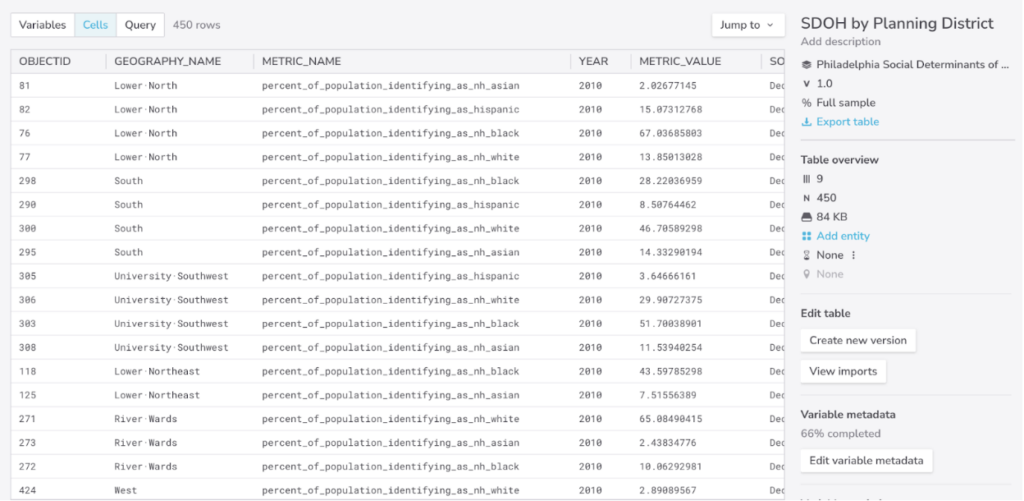
Philadelphia Social Determinants of Health data by planning district represents an example of how health outcomes and geographic data are merged and now accessible to further processing and transformation with other datasets.
Written by Sean Conner, MDI Scholar working on EIDC
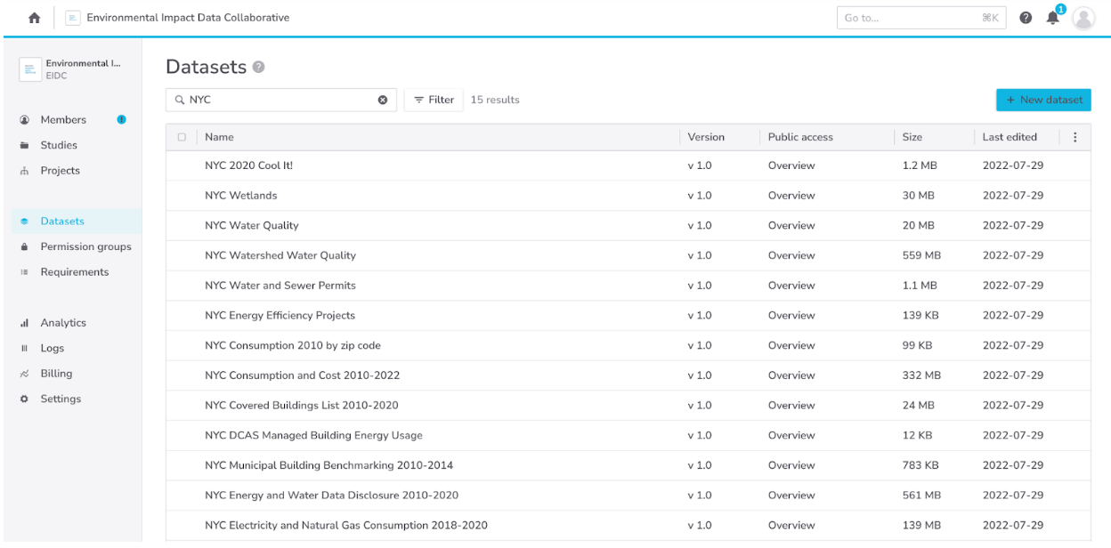
Header image caption: Datasets from the NYC Open Data Portal that have been ingested on the EIDC. While the NYC Open Data portal is one of the more developed city-based platforms, integrating this data into the data collaborative allows community members, policymakers, and researchers to query and visualize data at geographic scales as small as buildings or water fountains.